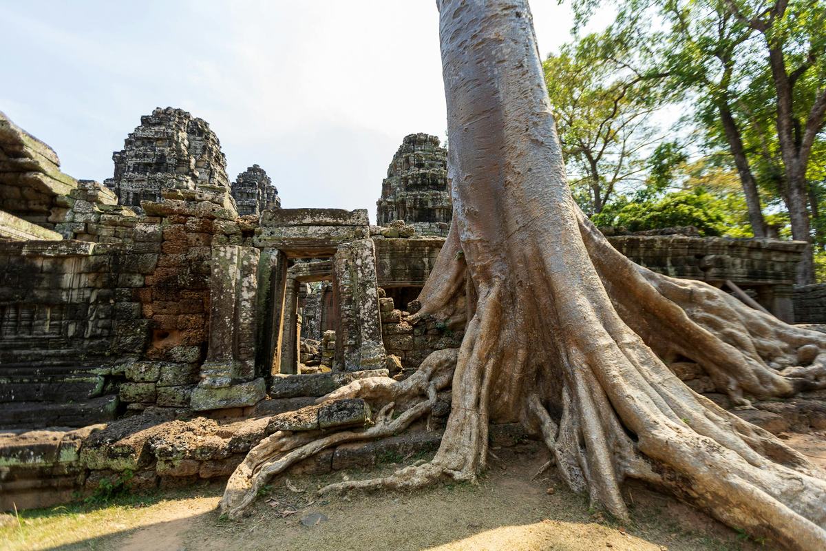
- Capital: Phnom Penh [1]
- Population: about 17 million [1]
- Area: 181,035 square kilometers [1]
- Official language: Khmer [1]
- Currency: Cambodian riel (KHR), with US dollars in wide everyday circulation [2]
- Distinguishing claim: home to Angkor Wat, the largest religious monument in the world by land area [3]
I had to look this up twice. Cambodia, a country smaller than the state of Oklahoma, is the only nation on Earth that puts a building on its flag. Not a star, not a sunburst, not a sword. A temple. And once you know which temple it is, the choice stops feeling decorative and starts feeling like a thesis statement.
Angkor Wat and the Scale Most Photos Miss
Angkor Wat covers roughly 162.6 hectares, which makes it the largest religious monument in the world by land area [3]. Photos never quite show this. You see the five towers, the reflecting pools, the cinematic sunrise shots, and your brain files it next to other big temples you've seen in books. Then you read that the outer wall runs more than three kilometers around and the moat is wider than a city block, and the whole thing rearranges itself in your head.
It was built in the early 12th century under King Suryavarman II, originally as a Hindu temple dedicated to Vishnu, and later converted into a Buddhist site as the religion of the Khmer Empire shifted [3]. That shift is part of what makes the place feel layered rather than frozen. Khmer Buddhism still uses the temple today. People pray there. It is not a ruin in the museum sense.
The wider Angkor archaeological park, which UNESCO inscribed as a World Heritage Site in 1992, covers about 400 square kilometers and contains the remains of several capitals of the Khmer Empire from the 9th to the 15th centuries [4]. For a few hundred years, Angkor was likely the largest pre-industrial city in the world by area, with a sprawling network of canals, reservoirs, and rice fields supporting a population that some researchers estimate ran into the hundreds of thousands.
A Flag That Tells You What the Country Thinks It Is
Most flags are abstract. Stripes, stars, a coat of arms. Cambodia just put Angkor Wat right in the middle of theirs, in white, against a red field with two blue bands [5]. It has been on the flag in some form since 1948, with a brief and grim interruption during the Khmer Rouge years and the subsequent decade of political reshuffling. The current design was readopted in 1993 [5].
Here's the thing about that choice. The temple on the flag is not just a monument. It is a claim about continuity, about who the Khmer people are and where they come from, after a 20th century that tried very hard to break that continuity.
Tonle Sap, the Lake That Runs Backward
The Tonle Sap is the largest freshwater lake in Southeast Asia, and once a year it does something almost no other major river system on Earth does. It reverses direction.
For most of the year, the Tonle Sap River drains the lake southeast into the Mekong. But during the monsoon, the Mekong swells so much that it pushes water back upstream, into the lake, expanding it from roughly 2,500 square kilometers in the dry season to as much as 16,000 square kilometers at peak flood [6]. The lake basically inhales the monsoon.
This pulse is the engine of Cambodian food security. The flooded forest around the lake is one of the most productive freshwater fisheries in the world, and millions of Cambodians get most of their protein from it [6]. Whole villages float on the water and follow the shoreline as it expands and contracts. I grew up around the Missouri River, and even there, when it floods, you talk about it for a year. The Tonle Sap floods on schedule and people build their lives inside that schedule.
A New Year in April, Three Days Long
Khmer New Year falls in mid-April, usually April 13 to 16, marking the end of the harvest and the start of the dry-to-wet seasonal turn [7]. It is not the calendar year change you would think of from a Western frame. It is agricultural and religious, lining up with similar new year celebrations in Thailand and Laos.
Each of the three days has its own meaning, with families visiting pagodas, washing Buddha statues, and pouring water over the hands of elders to ask for blessings [7]. Public life basically pauses. If you are trying to do business in Cambodia in April and you didn't check the calendar, you find out fast.
The Currency Situation Almost No One Explains
Cambodia has its own currency, the riel, but the US dollar is used so widely in daily life that prices are often quoted in dollars and change comes back as a mix of both [2]. ATMs typically dispense dollars. A cup of coffee might cost two dollars. Five hundred riel in change.
This is not a quirk. It is a legacy of the early 1990s, when the United Nations Transitional Authority in Cambodia spent vast sums of US dollars during the post-conflict transition, and the dollar economy never fully went away [2]. The government has been pushing for years to "de-dollarize" and put more weight on the riel, with some success in recent years, but if you walked into a shop in Phnom Penh tomorrow, you would still be quoted in dollars more often than not [2].
Which, if you think about it, is a strange thing about national identity. The flag says one thing about continuity. The cash register says something else.
The Khmer Empire's Engineering Was Quietly Wild
Long before Angkor became a tourist itinerary, the Khmer Empire built a hydraulic system that historians and engineers are still trying to fully understand. The two giant reservoirs near Angkor, the West Baray and the East Baray, each held millions of cubic meters of water and were linked to a network of canals that fed both ritual and agricultural needs [4]. Satellite imaging has shown that the urban footprint of greater Angkor extended far beyond the temple complex, with low-density settlement spread across hundreds of square kilometers, threaded together by water management infrastructure.
That infrastructure is also part of why Angkor declined. By the late 14th and 15th centuries, climate shifts including severe droughts and intense monsoons appear to have stressed the water system past its limits, and the political center of the Khmer world moved south toward Phnom Penh [4]. A civilization brought down, in part, by the same water it had spent centuries learning to control.
Frequently Asked Questions
What is Cambodia best known for?
Cambodia is best known for Angkor Wat, the largest religious monument in the world, and for the broader Angkor archaeological park, a UNESCO World Heritage Site that contains the remains of the Khmer Empire's capitals. The country is also known for the Tonle Sap lake and a complex 20th-century history.
What language do they speak in Cambodia?
The official language of Cambodia is Khmer, which is spoken by roughly 95 percent of the population. Khmer uses its own script, descended from a southern Indian writing system, and is one of the oldest continuously written languages in Southeast Asia. English and some French are also used.
What currency is used in Cambodia?
Cambodia's official currency is the riel (KHR), but the US dollar is used very widely in daily transactions, often alongside the riel. Prices in cities are commonly quoted in dollars, with riel typically used for small change. ATMs in tourist areas usually dispense US dollars.
Is Cambodia safe to visit?
Cambodia is generally considered safe for tourists, with petty theft in busy areas being the most common concern. The major tourist regions, including Siem Reap and Phnom Penh, have well-developed visitor infrastructure. Travelers should still follow standard precautions and check current government travel advisories before going.
When is the best time to visit Cambodia?
The best time to visit Cambodia is during the dry season, from November to March, when temperatures are cooler and rainfall is minimal. April is extremely hot, and the wet season from May to October brings heavy afternoon rains, though the landscape is greener and the Tonle Sap is at its fullest.