- Capital: N'Djamena [1]
- Population: about 18 million [1]
- Area: 1,284,000 square kilometers [1]
- Official languages: French and Arabic [1]
- Currency: Central African CFA franc (XAF) [2]
- Distinguishing claim: home to the Ennedi Massif, a UNESCO World Heritage site with rock art going back 7,000 years [3]
I grew up thinking the Sahara stopped somewhere in Algeria. Then I pulled up a map of Chad and saw that roughly the northern half of this country, a country bigger than Texas and California combined, is straight desert. The southern half is savanna and farmland. The middle is the Sahel, that semi-arid belt where the two worlds bleed into each other. Chad is one of the few places on Earth where you can drive from a wetland fringed with hippos to a desert plateau covered in Stone Age paintings without ever crossing a border.
A Lake That Used to Be an Inland Sea
Lake Chad sits in the southwest, on the border with Cameroon, Niger, and Nigeria, and it is the reason people have lived in this part of Africa for thousands of years. It is also one of the most dramatic environmental stories on the planet. In the 1960s, Lake Chad covered about 25,000 square kilometers, roughly the size of Vermont. Today it is closer to 1,500 square kilometers, a shrinkage of more than 90 percent in a single human lifetime [4]. Drought, irrigation, and climate change all played a part.
Go back further and the change is even harder to picture. Around 7,000 years ago, during a wetter period geologists call the African Humid Period, what is now Lake Chad was Mega-Chad, an inland sea covering more than 350,000 square kilometers. It would have been one of the largest lakes on Earth at the time [5]. The dry lakebeds, salt flats, and fossil shorelines you can still find scattered across the Sahara north of the current lake are what is left of it.
The Ennedi Massif and Seven Thousand Years of Art
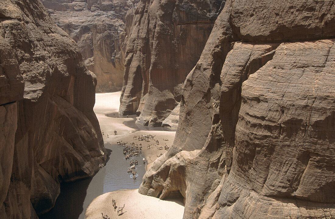
Up in the northeast, in the middle of the desert, the sandstone of the Ennedi Plateau has been carved by wind and rare rainfall into arches, towers, and labyrinths that look almost engineered. Tucked inside the rock shelters and overhangs are thousands of paintings and engravings, made by people who lived here when the Sahara was green [3]. You see cattle, giraffes, hunters, dancers, camels - the whole sweep of human and animal life across millennia, painted on rock that scientists now use to date the climate shifts that ended the Humid Period.
The Ennedi was made a UNESCO World Heritage site in 2016, listed for both its natural and cultural value [3]. It is one of the most remote World Heritage sites on the planet, days of overland travel from the capital, and almost nobody outside Chad has heard of it. Which, if you think about it, is a kind of protection in itself.
More Than a Hundred Languages, Officially Two
French and Arabic are Chad's two official languages, a holdover from French colonial rule that ended in 1960 and from centuries of Arab-Islamic influence reaching down from North Africa [1]. But the everyday linguistic map looks completely different. Linguists count more than 120 distinct languages spoken across the country, from Sara in the south to Kanuri around Lake Chad to Zaghawa in the eastern desert [6]. Chadian Arabic, a regional variety used as a trade language, is what a lot of people actually use to talk across ethnic lines.
Schools formally teach in French and Standard Arabic, and government documents come out in both. Outside of those rooms, you might hear half a dozen languages in the same market in N'Djamena. Back home in Montana, my whole high school spoke one language. Walking around a Chadian market is a different planet.
Oil Money and a Difficult Geography
Chad is one of the poorest countries in the world by per-capita income, and it is also a significant oil producer [1]. Oil started flowing through a pipeline to the Cameroon coast in 2003, and crude exports now make up the largest share of government revenue [7]. The trouble is that being landlocked, with the nearest port more than a thousand kilometers away, makes everything else expensive. Imports come overland through Cameroon or Sudan, and a single road closure can spike prices in the capital.
The country has also absorbed waves of refugees - from Sudan during the Darfur conflict, from the Central African Republic, from northeastern Nigeria - making it home to one of the largest refugee populations in Africa relative to its size [8]. None of this shows up in a list of geographic curiosities, but it is the lived reality wrapped around every other fact about the country.
Frequently Asked Questions
What is Chad best known for?
Chad is best known for Lake Chad, one of Africa's largest lakes that has shrunk dramatically since the 1960s, and for the Ennedi Massif, a UNESCO World Heritage site famous for ancient rock art and dramatic sandstone formations. It is also known as a major Sahelian country and oil producer.
What languages are spoken in Chad?
The two official languages are French and Arabic, but more than 120 indigenous languages are spoken across the country. Chadian Arabic functions as a widely used everyday lingua franca, while Sara, Kanuri, and Zaghawa are among the largest local languages by number of speakers.
What currency is used in Chad?
Chad uses the Central African CFA franc (XAF), a regional currency shared with five other Central African states and issued by the Bank of Central African States. The CFA franc has historically been pegged to the euro and is accepted across all member countries.
Is Chad safe to visit?
Travel to Chad carries significant risks, including armed banditry, terrorism in border regions, and unstable security in parts of the north and around Lake Chad. Most Western governments advise against non-essential travel. Visitors should check current advisories and arrange experienced local support in advance.
What is the climate like in Chad?
Chad's climate ranges from hot desert in the Saharan north, with very little rainfall, to tropical savanna in the south with a distinct rainy season from May to October. The Sahel belt in the middle is semi-arid. Temperatures regularly exceed 40 degrees Celsius in the hottest months.