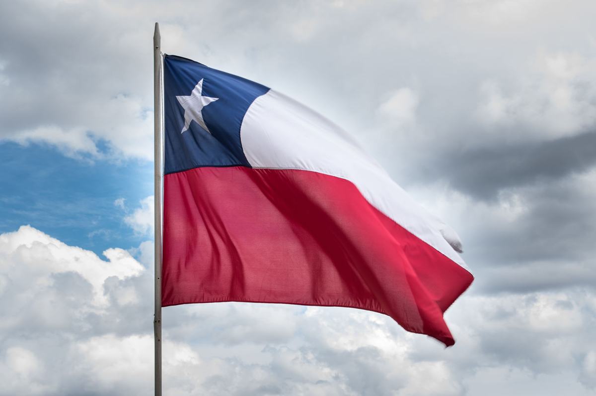
Chile at a glance
- Capital: Santiago[^1]
- Population: about 19.6 million (2023)[^2]
- Area: 756,950 km² (292,260 sq mi)[^1]
- Official language: Spanish; Mapudungun and Rapa Nui have regional recognition[^3]
- Currency: Chilean peso (CLP)[^1]
- Stretches roughly 4,300 km north to south, averaging just 177 km wide[^3]
Here's something that'll mess with your sense of geography. If you laid Chile across the United States, it would stretch from northern Maine all the way down past central Mexico. The country is so long that the climate at one end is the driest desert on Earth, and at the other end glaciers calve into the sea. And yet Chile is, on average, only about 110 miles wide. You can drive across it in two hours. North to south, it would take you four days.
That ratio - long and narrow with extremes at every latitude - explains a lot about why Chile is the way it is. The rest of this piece is a kind of unpacking of that one shape.
Geography: A Long, Narrow Country
Chile runs about 4,300 kilometers - roughly 2,670 miles - from its border with Peru in the north to Cape Horn at its southern tip.[^3] That makes it one of the longest countries in the world end to end. Strung along the Pacific coast of South America, it touches the desert tropics in the north and sub-Antarctic glaciers in the south. In between sit Mediterranean valleys, mountain ranges, fjords, volcanoes, vineyards, and temperate rainforest. Six climate zones in one country.
The width is the other half of the story. Average: about 110 miles. At the narrowest, around 40 miles.[^3] The Andes form the eastern wall almost the entire length, and the Pacific runs along the west. Chile is, geographically, a very thin slice of land squeezed between a mountain range and an ocean.
That shape is the secret to a lot of what follows. It's why Chile has the driest desert on the planet and one of the wettest forests within the same passport. It's why every storm system that hits the country slams into either the Andes or the sea before it can spread. It's why someone growing up in Punta Arenas in the south might never set foot in the desert, and a kid in Arica in the north might not see snow until they leave the country.
The Atacama: Driest Place on Earth
The Atacama Desert in northern Chile is the driest non-polar desert on the planet.[^4] Some weather stations there have never recorded measurable rainfall. Parts of it are so dry that NASA uses the soil as a Mars analog when it tests rovers and life-detection instruments.[^4]
Here's the thing about the Atacama: it isn't just dry, it's old-dry. Researchers estimate parts of it have been hyperarid for around 15 million years. Long enough that the surface chemistry - high in nitrates and sulfates that would normally wash away - looks more like a lab sample than a landscape.
But it isn't lifeless. There are oases, salt flats with flamingos, agave fields, and the surreal blue-green lagoons of the altiplano. After rare rains, the desert blooms - a phenomenon called desierto florido - when dormant seeds wake up and turn the ground purple, white, and yellow for a few weeks. I had to see the photos before I believed it.
The Strongest Earthquake on Record
On May 22, 1960, Chile experienced the most powerful earthquake ever measured by modern instruments. The Valdivia earthquake registered magnitude 9.5.[^5] It killed at least 1,655 people in Chile and triggered tsunamis that reached Hawaii, Japan, and the Philippines, where they caused additional deaths thousands of miles from the source.[^5]
Chile sits on the boundary of the Nazca and South American plates, one of the most seismically active subduction zones in the world. The result is a country that has had to design buildings, schools, and ports to withstand events most other places simply hope never happen. Modern Chilean seismic codes are some of the strictest on Earth, and they show. The 2010 Maule earthquake, an 8.8, killed about 525 people[^6] - a tragedy by any measure but a fraction of what an 8.8 would do almost anywhere else.
Turns out, living on a fault line for centuries teaches you things.
Astronomy: The Telescopes of the Atacama
By 2030, Chile will host more than 70% of the world's astronomical observation infrastructure.[^7] That's not a typo. The northern Atacama gives astronomers three things they can't easily get anywhere else: high altitude (less air between you and the stars), almost no humidity (water vapor scrambles infrared), and stable dark skies (almost no light pollution for hundreds of miles).
The Atacama Large Millimeter Array - ALMA - sits at 5,000 meters, sixty-six antennas working together as a single radio telescope.[^7] It has imaged planet-forming disks around young stars and helped capture the shadow of a black hole. The European Southern Observatory's Extremely Large Telescope, going up in the same desert, will be the largest optical telescope ever built when it comes online later this decade.
Chile didn't engineer this. The geography just happens to put a near-perfect window on the universe inside the country, and Chilean national astronomy programs have grown around the foreign observatories that came for the sky.
Easter Island and the Reach of Chile
Easter Island - Rapa Nui to the people who live there - sits 3,700 kilometers off Chile's coast in the South Pacific.[^8] It's one of the most isolated inhabited places in the world, and it's a Chilean territory. That gives Chile one of the longest national sea reaches of any country.
The island is famous for the moai, the roughly 1,000 stone figures the Rapa Nui people carved between about 1250 and 1500 CE.[^8] Some of them weigh more than 80 tons. How a small population on a volcanic island built and moved them is still a partly open question, with current research pointing to a "walking" technique using ropes and human power.
UNESCO designated Rapa Nui National Park as a World Heritage Site in 1995.[^8] The local language is Rapa Nui, the second indigenous language after Mapudungun with official regional standing in Chile.
Lithium and Copper: Chile's Mineral Power
Chile produces more copper than any other country on Earth - about a quarter of the world's supply.[^9] The Escondida mine in the Atacama is the single largest copper-producing mine on the planet. If you've used a phone, a laptop, or a power line in the last decade, some of that copper probably came from Chilean rock.
Lithium is the newer story. Chile sits on roughly a quarter of the world's lithium reserves, mostly under the brine flats of the Salar de Atacama.[^9] Every electric car battery built today depends, directly or indirectly, on a global lithium supply chain that runs through Chile. It's a strange thing to think about: the same flats where flamingos wade through pink saltwater are also part of the infrastructure of the energy transition.
The country is currently rewriting how lithium is extracted, with new state-led partnerships and a national lithium strategy launched in 2023. What happens here in the next decade will affect what an electric car costs in the decade after that.
Frequently Asked Questions
What is Chile most known for?
Chile is best known for being one of the longest countries in the world, the world's driest desert (the Atacama), and one of the most seismically active places on Earth. It is also a leading global producer of copper and lithium, and it administers Easter Island, home to the moai statues.
Why is Chile so long and narrow?
Chile's shape is set by the Andes Mountains to the east and the Pacific Ocean to the west. The country runs about 4,300 kilometers north to south along this corridor and averages only 177 kilometers wide, making it one of the most geographically extreme countries in the world.
What language do they speak in Chile?
Spanish is the official language of Chile and is spoken by over 99% of the population. Two indigenous languages, Mapudungun and Rapa Nui, hold regional official status. Chilean Spanish has its own distinct vocabulary, slang, and rapid speech style that other Spanish speakers often find challenging.
Why does Chile have so many earthquakes?
Chile sits along the boundary where the Nazca tectonic plate slides under the South American plate, one of the most active subduction zones on Earth. This produces frequent and powerful earthquakes, including the 1960 Valdivia earthquake at magnitude 9.5, the strongest ever recorded with modern instruments.
Sources
[^1]: CIA World Factbook - Chile - https://www.cia.gov/the-world-factbook/countries/chile/ [^2]: World Bank - Chile country data - https://data.worldbank.org/country/chile [^3]: Britannica - Chile (geography and languages) - https://www.britannica.com/place/Chile [^4]: NASA Earth Observatory - Atacama Desert - https://earthobservatory.nasa.gov/images/152373/the-driest-place-on-earth [^5]: USGS - M 9.5 - 1960 Great Chilean Earthquake - https://www.usgs.gov/programs/earthquake-hazards/science/m95-1960-great-chilean-earthquake [^6]: USGS - M 8.8 - Offshore Bio-Bio, Chile (2010) - https://earthquake.usgs.gov/earthquakes/eventpage/official20100227063411530_30/executive [^7]: European Southern Observatory - ESO and Chile - https://www.eso.org/public/about-eso/whatiseso/ [^8]: UNESCO World Heritage Centre - Rapa Nui National Park - https://whc.unesco.org/en/list/715 [^9]: USGS - Mineral Commodity Summaries (Copper, Lithium) - https://www.usgs.gov/centers/national-minerals-information-center/mineral-commodity-summaries