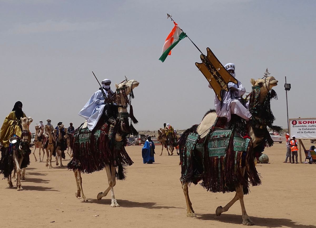
- Capital: Niamey [1]
- Population: about 27 million, with the youngest median age of any country in the world at around 15 years [2]
- Area: 1,267,000 square kilometers (489,000 square miles), the largest country in West Africa [1]
- Official language: French, with Hausa, Zarma, Fulfulde, Tamasheq, and several other national languages [1]
- Currency: West African CFA franc (XOF)
- Distinguishing claim: roughly 80 percent of the country sits inside the Sahara Desert, yet it takes its name from a river that only flows through the country's southwest corner [3]
I grew up thinking the Sahara was somewhere else, somewhere over by Egypt and the pyramids. Then I started reading about Niger and realized the Sahara is mostly Niger. Or Niger is mostly Sahara, depending on how you want to say it. The country is enormous, about twice the size of Texas, and the great majority of that area is sand and rock and the kind of horizon that doesn't end. The capital, Niamey, sits down in the green southwest corner along the Niger River, and from there the country stretches north for over a thousand kilometers into dunes and plateaus where almost nobody lives.
The name is the first thing worth getting straight. Niger is named after the Niger River, which is the third longest river in Africa, but the river only clips the southwestern edge of the country before swinging south into Nigeria. The two countries share more than a name. They share a river, a border, and a lot of cultural history. But Niger is the desert one, the landlocked one, the one that almost nobody in the United States can place on a map.
The Sahara Takes Up Most of the Country
The northern two thirds of Niger is the Sahara proper, including the Ténéré, a stretch of sand so empty that the Tuareg name for it just means "where there is nothing". The Ténéré is famous for a tree that stood alone in the middle of the dunes for decades, the most isolated tree on Earth, until a truck driver hit it in 1973. The skeleton of it is now in the national museum in Niamey, and a metal sculpture stands where the tree used to be.
Rising out of the Ténéré is the Aïr Mountains, a volcanic massif where the Tuareg have herded camels and traded salt for centuries. The Aïr and the surrounding desert are a UNESCO World Heritage site, partly for the landscape and partly for the rock art. Engravings of giraffes, elephants, and cattle cover the cliffs, evidence that this part of the Sahara was a wet savanna only a few thousand years ago [4].
The Niger River Corner
The Niger River cuts a green crescent through the southwestern tip of the country, and that corner is where most Nigeriens live. Rice paddies, millet fields, mango trees, and fishermen with conical hats line the banks. Niamey itself is a low, dusty city of about 1.5 million, built on a bluff above the river, with the muezzin's call mixing with motorbike horns at dawn.
The river is also where the country's most surprising piece of paleontology came out of the ground. Sereno's team and others have dug up huge dinosaurs near the village of Gadoufaoua, including Nigersaurus, a wide-mouthed plant-eater with about 500 teeth that worked like a vacuum cleaner. The fossil beds in the Tenere are so rich that bones literally weather out of the sand and lie on the surface waiting to be collected.
The Youngest Country on Earth
Here's a statistic that stopped me cold. The median age in Niger is around 15 years old, the lowest in the world, and the fertility rate of nearly six children per woman is the highest [2]. About half the population is under the age of 15. Walk through a market in Niamey or a village in Tahoua and you'll see kids everywhere, in school uniforms, carrying water, herding goats, selling phone cards.
That demographic shape is going to define the country for the rest of the 21st century. By 2050, the United Nations projects Niger's population could double to around 50 million. Most of that growth will happen in towns along the Niger River and in the Hausa-speaking south, where the rains still fall reliably.
Uranium, Salt, and the Caravan Trade
Niger sits on some of the largest uranium reserves in Africa, and for decades the mines around Arlit have supplied French nuclear power plants. The trade is politically complicated and the share of revenue that stays in Niger has been a constant point of negotiation.
The older trade is more romantic. The Azalai, a twice-yearly camel caravan, still crosses the Ténéré between the oasis of Fachi and the salt flats of Bilma. The caravans carry millet north and bring back blocks of salt and dates. They've been doing this for over a thousand years and you can still see camel trains a kilometer long crossing the dunes if you know when to look.
Frequently Asked Questions
What is the capital of Niger?
The capital of Niger is Niamey, located on the Niger River in the southwestern part of the country. It is the largest city, with a population of about 1.5 million, and serves as the political, cultural, and economic center.
Is Niger the same as Nigeria?
No. Niger and Nigeria are two different countries that share a border and a river. Niger is the larger, mostly desert country to the north, with about 27 million people. Nigeria is the smaller but far more populous country to the south, with over 200 million.
What language do they speak in Niger?
French is the official language, used in government and schools. Most people also speak one or more national languages, including Hausa, Zarma, Fulfulde, Tamasheq, Kanuri, and Arabic. Hausa is the most widely spoken language in everyday life.
What is Niger famous for?
Niger is known for the Sahara Desert, the Tuareg and Hausa cultures, the Niger River, the Aïr Mountains, rich uranium deposits, and the dinosaur fossil beds of the Ténéré. It is also the country with the youngest population in the world.
Is Niger safe to visit?
Travel conditions in Niger have been restricted in recent years because of security concerns, particularly in the north and along the borders with Mali and Burkina Faso. Most foreign governments currently advise against non-essential travel, and visitors should check current advisories before planning a trip.