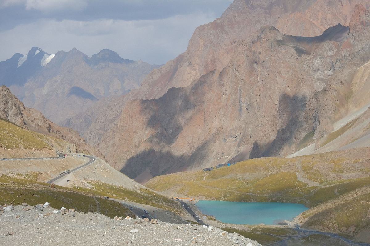
- Capital: Dushanbe [1]
- Population: about 10.5 million [2]
- Area: 143,100 square kilometers [1]
- Official language: Tajik (a variety of Persian) [1]
- Currency: Tajik somoni (TJS)
- Distinguishing claim: more than 90 percent of the country is mountainous, and roughly half of it sits above 3,000 meters [1]
I grew up thinking the highest places on earth were all in Nepal. Then I started reading about the Pamirs and had to sit down for a minute. Tajikistan is a small, landlocked country tucked between Afghanistan, China, Kyrgyzstan, and Uzbekistan, and a stunning amount of it is straight up. The eastern half of the country is essentially one enormous high-altitude plateau, with peaks that rival anything in the Himalayas and valleys that sit higher than most American mountain summits. It is the kind of place that ruins your sense of scale.
The Pamirs: The Roof of the World
The Pamir Mountains take up the eastern half of Tajikistan, and locals have called them Bam-i-Dunya, the Roof of the World, for centuries [1]. Three of the country's peaks pass 7,000 meters: Ismoil Somoni Peak at 7,495 meters, Ibn Sina Peak at 7,134 meters, and Korzhenevskaya Peak at 7,105 meters. For comparison, the tallest mountain in the lower forty-eight US states tops out around 4,400 meters. You could stack one and a half Mount Whitneys on top of each other and still not match Ismoil Somoni.
What's wild is that the Pamir Highway, a single road that crosses this whole region, sits at an average elevation higher than most ski resorts in Colorado. The road climbs over the Ak-Baital Pass at 4,655 meters, which is higher than any paved road in North America. Truckers and adventure cyclists who tackle it sometimes need a few days at altitude just to function.
Lake Sarez: A Lake That Could End a Country
In 1911, an earthquake shook a massive piece of mountain loose in the Pamirs. It slid down and dammed the Murghab River, creating Lake Sarez almost by accident. The lake is now around 60 kilometers long and more than 500 meters deep, held back by the Usoi Dam, the tallest natural dam on earth [3].
Here is the thing nobody talks about. If another quake takes out the Usoi Dam, the water released would race down through the valleys of Tajikistan, Afghanistan, Uzbekistan, and Turkmenistan, and could potentially affect millions of people living downstream along the Amu Darya river system. Engineers from several countries have studied the lake for decades, and monitoring equipment is in place, but the geology of the region remains restless. It is one of the more dramatic natural risks anywhere in Asia, and most people outside the region have never heard of it.
A Persian Country in a Turkic Neighborhood
Most of Central Asia speaks a Turkic language, including Kazakh, Uzbek, Kyrgyz, and Turkmen. Tajikistan is the odd one out. Tajik is a variety of Persian, closely related to the Farsi spoken in Iran and the Dari spoken in Afghanistan [1]. The three languages are largely mutually intelligible, with some differences in vocabulary and pronunciation.
This linguistic split goes a long way toward explaining Tajik culture. The poetry of Rumi, Hafez, and Ferdowsi belongs to Tajiks as much as to Iranians. Persian New Year, Navruz, is the biggest holiday of the year [4]. Traditional music uses Persian musical modes. The food leans toward pilafs, flatbreads, and slow-stewed meats that would feel familiar to anyone who has eaten across the Persian-speaking world. When the country picked a national hero after independence, it chose Ismoil Somoni, a tenth-century Persian ruler whose dynasty governed much of Central Asia from Bukhara. His face is on the money.
The Highest Capital in Central Asia, Sort Of
Dushanbe, which means Monday in Tajik because it grew up around a Monday market, sits at about 800 meters elevation. That is not particularly high by Tajik standards, but it is the lowland anchor of a country that climbs sharply to the east. Walk a few hours out of the city and you are in foothills. Drive a day and you are at three thousand meters with snow on the road.
The city is fairly young as Central Asian capitals go. It was a small village until the Soviets developed it in the 1920s and 1930s. Today it has wide boulevards, the world's second-tallest flagpole at 165 meters [5], and one of the largest tea houses in Central Asia, the Kohi Navruz. It is a quiet capital, far quieter than its size would suggest, partly because so much of the country's population lives in the rural mountain districts rather than the urban core.
The Wakhan Corridor and a Border That Almost Touches India
In the far southeast, Tajikistan shares a thin strip of border with Afghanistan along the Wakhan Corridor. The corridor itself is a narrow finger of Afghan territory that was carved out by the British and Russians in the nineteenth century to keep their empires from bumping into each other. It separates Tajikistan from Pakistan by only about 15 kilometers at the narrowest point. Look at it on a satellite map and the geography is almost comic. A wall of mountains, then a sliver of valley, then more mountains, then a different country entirely.
This is also one of the last strongholds of the Pamiri people, an ethnic minority who speak a cluster of related Eastern Iranian languages distinct from Tajik. They have their own musical traditions, their own architectural styles, and a form of Ismaili Shia Islam that sets them apart from the mostly Sunni population in the rest of the country. Their houses, built with five symbolic pillars representing elements of their faith, are quietly some of the most beautiful traditional dwellings in Central Asia.
A Civil War the World Mostly Forgot
Tajikistan went through one of the worst civil wars of the post-Soviet era, fought from 1992 to 1997 between the central government and an opposition coalition that included regional, Islamist, and democratic factions [1]. Estimates put the death toll between 50,000 and 100,000 people, with hundreds of thousands more displaced. For a country of fewer than seven million at the time, the demographic and economic damage was enormous.
Recovery has been slow and uneven. The country remains one of the poorest in the former Soviet sphere, and a meaningful share of GDP comes from remittances sent home by Tajiks working in Russia. But the mountains, the languages, the poetry, and the long thread of Persian civilization are still there, doing what they have done for centuries.
Frequently Asked Questions
Where is Tajikistan located?
Tajikistan is a landlocked country in Central Asia, bordered by Afghanistan to the south, China to the east, Kyrgyzstan to the north, and Uzbekistan to the west. It is the smallest country in Central Asia by area and contains a section of the Pamir Mountains.
What language do people speak in Tajikistan?
Tajik is the state language and is a variety of Persian, closely related to the Farsi of Iran and the Dari of Afghanistan. Russian is widely used in business and government, and some Pamiri languages are spoken in the eastern mountains.
Is Tajikistan safe for tourists?
Tajikistan is generally considered safe for travelers, especially for trekking and adventure tourism in the Pamir and Fann mountains. Visitors should check current advisories for the Afghan border region and obtain the required permits for the Gorno-Badakhshan Autonomous Region in the east.
What is Tajikistan known for?
Tajikistan is known for the Pamir Mountains, the Pamir Highway, its Persian linguistic and cultural heritage, the deep alpine Lake Sarez, and being the smallest and most mountainous country in Central Asia. The country celebrates Navruz as its biggest annual holiday.
Do you need a visa to visit Tajikistan?
Most foreign visitors can apply for an electronic visa online before traveling, and citizens of several countries qualify for visa-free entry for short stays. Travel to the Gorno-Badakhshan Autonomous Region requires an additional permit that can be issued together with the e-visa.